The second hike from Cumberland, MD to Washington D.C. was just completed; almost 5 years after the first hike. I’d like to share here some updated thoughts and experiences for anyone that is contemplating this adventure.
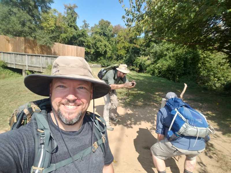
We left Cumberland early Saturday morning September 16th for ten days of hiking. The weather was unusually warm for this time of year. Mid to upper 80s during the day and 60s at night. There was no rain, but there were a few wet and muggy days. This time we started and ended with three people.
Learning from our last time on this trail, we all worked on lightening our packs, switching from boots to trail runners, leaving the hiking poles at home, and going from tents to hammocks. We had more re-supply stops by family members, and took better advantage of food and equipment provided by local shops along the way.
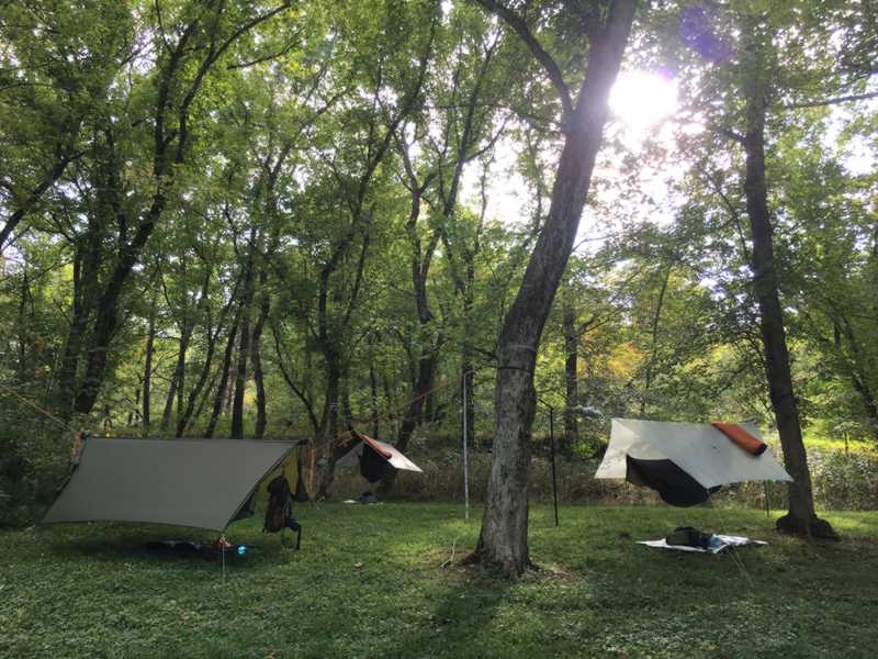
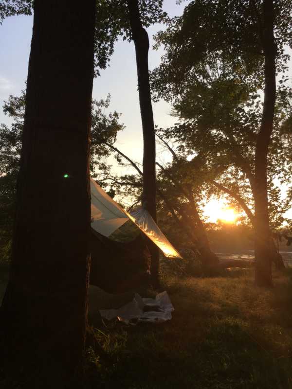
Hammocks added new challenges, but overall I found it superior to sleeping on the ground. If planned carefully, it can be done with less weight than most tents, and the comfort can be much better hanging once the mechanics are fully worked out. There are negatives. One of our planned stops didn’t have enough trees for three hammocks, so we put in another 6 miles to get to the next site which was exhausting. The complexity involved with a hammock is usually greater than ground sleeping. Tree distances, trunk sizes, hang angles, hang height, tarp rigging, under quilt suspension… One could spend a long time fiddling and adjusting to get everything just right. Then you have to find just the right diagonal to lay on and just the right spot to be laying relatively flat…
But waking up in the hammock for me was so nice. No soreness. No pressure points. It was rejuvenating sleep that made the next day that much easier.
I tried to follow my own advice from last time and not actually carry water. I drank my fill when we stopped at water sources. A couple of times, I was grateful to “borrow” a drink from Doug or John who preferred to keep water on hand as they walked. However, I’m still glad I didn’t usually carry any water which made my load that much lighter. Many times I noticed that they carried the water but didn’t drink any until we stopped. Most of our stops had water available. A few times we anticipated long, hot walks between water sources and I would break down and carry 24 oz.
I feel that the hike was significantly easier this time around. Largely because of the pack weight reduction, footwear changes, and better weather. It was uncomfortably warm most days, but I think that beats cold, wet, and shivering.

This time we wore long pants and long sleeves, which for me helped with bug issues. I didn’t use much Deet this time around, but my clothes were all treated with Permethrin. I only had one major bug problem on the last night, and I’ll talk about that a bit later. I said “bit”. Ha!
The feet did well this time. We suspect the mid-top boots we had last time were a problem. Last time, the foot pain was spectacular. This time, other than a few blisters, our feet were fine. We used Leukotape for blisters and blister prevention, and we used some hike goo between the toes for lubricant, though I don’t know if it was necessary. Lighter packs and trail runners that allow water in and out are probably the key. My socks were wet a few times, but they dried quickly. That keeps the blisters down.
Tyvek Home Wrap: I can’t recommend it enough. Cheap, tough, light, easy to clean. It kept me and my pack clean(er). I balled it up repeatedly until the noise went away, which made it soft and pliable.
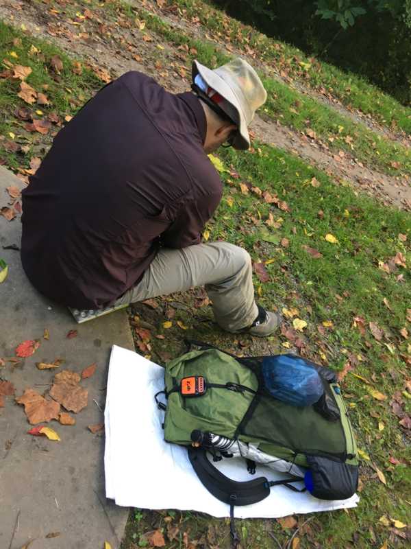
You can see on my pack above that I carried an orange Spot Messenger. Cell service is rare for the first half of the hike, a strong lesson from last time. This time we had the ability to let people see where we were and how we were doing even if we were days away from a phone call. Fortunately, we didn’t need to call for help this time. It made a nice record of our trip as well:
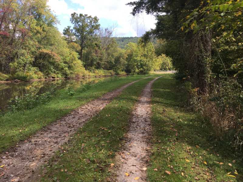
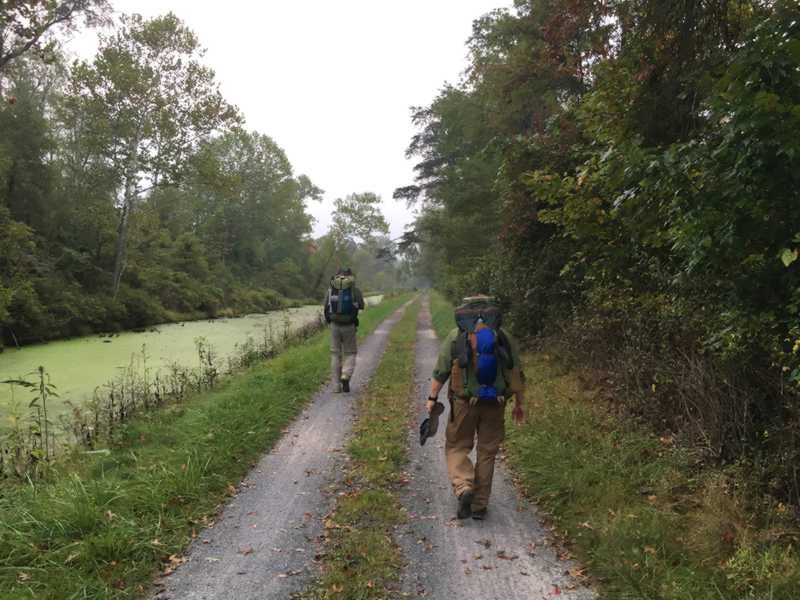
As you can see, we caught the park service between mowings. Perhaps half the trail was overgrown. We would get very wet wading through this grass to set up hammocks, or have a quick break at the picnic table. It also contributed to insects, snakes, and ticks being a bigger issue than usual. Long pants and Permethrin are a necessity!

Nobody brought stoves this time. We ate cliff bars, pro bars, green belly, chips, tortillas, spam, candy, and what-have-you. We got pizza in Hancock, sandwiches at White’s Ferry, and hot dogs and ice cream at Fletcher’s Cove. For the re-supply stops they brought subs and grilled up hamburgers. We also stashed some food to eat just at the re-supply stops, including various chips and snacks we packed in our re-supply bags.
We all added gaiters to our gear. They kept the rocks out of our shoes and it made it so much easier for us. Highly recommended. Not constantly stopping to dump gravel out of our shoes seemed to speed things up compared to last time.
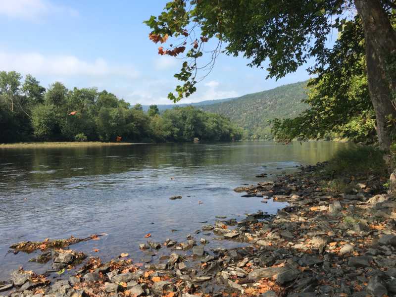
Last time, we took one bath in the river. This time, we took several. The river level was lower than last time, which helps a great deal to avoid mud when getting in and out. The water instantly cooled us down and soothed our aching feet. One thing I didn’t carry that my companions did was spare clothes. That means that I stood around trying to dry off before getting in the hammock, while they were clean and cozy in dry clothes.
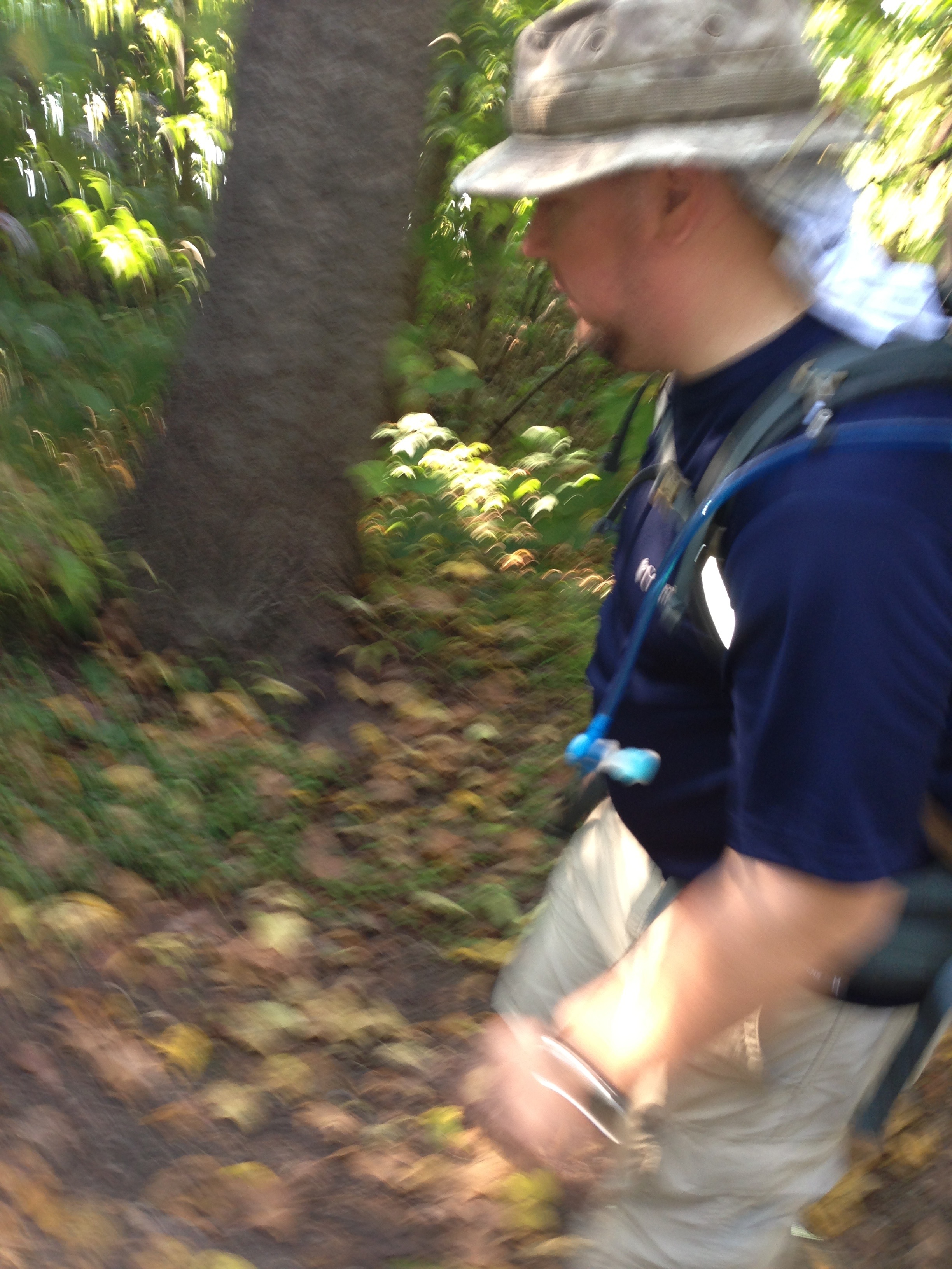
Some of the un-needed extras that I brought along included a chrome dome umbrella, and a rain kilt. I carried a light down jacket and a down hood to wear at night. I needed none of these things, but I don’t regret carrying them anyway. If we had rain and it had been cooler at night, I would have needed them. The jacket and hood served as a nice pillow, so they weren’t completely useless. I used my head bug net (above) most of the time. That saved me from the constant annoyance of gnats, mosquitoes, and spider webs. I admit it was a bit stifling though, especially in the heat but I’m glad I had it.
I turned into a major gram weenie this time around. My base pack weight was 9 pounds. All of these photos were taken by John and Doug because I was too stingy with weight to bring my phone and charger along. On the second half, I took the phone out of my re-supply and carried it, but didn’t have a charger or battery pack so I left the phone off. I was able to call home to my Wife each evening after that which was very uplifting. I overshot my food estimate by about 20%, which I think was a good thing. Better to have too much than not enough when it comes to energy. That added a couple pounds though. I had no spare clothing at all, just enough soap, just enough tooth paste, and just enough of a tooth brush. I bought cuben fiber everything and made it my mission to be as light as possible. Almost nothing came with me that I didn’t consider a necessity.
Did it help? Absolutely. It was so much easier this time than last. How much it helped, I don’t know. The shoes helped. The weather helped. The comfortable hammock helped. That I’m 50 pounds lighter personally than I was last time also helped. I think maybe I could have brought a couple more pounds of comfort items this time around and been fine. If I had it to do over, I’d bring sleeping clothes and a battery to charge my phone.
The last night.. This was Swain’s Lock, which is the last hiker/biker campsite on the trail when south bound. I mentioned a bug problem and this photo was taken in the middle of it. The last night was the warmest. Most nights, I had my top quilt around my feet, and a pad under them to keep the chill out. My under quilt is a 3/4 length, (because I’m such a gram weenie), so the sit pad is necessary to insulate my lower extremities. It was so warm the last night that I did not use the top quilt or the pad and slept with my skin exposed to the hammock. I didn’t realize it until I got home the next evening, but the mosquitoes chewed on my calves and the bottoms of my feet right through the hammock fabric all night long. So if you bring a hammock, I suggest treating the hammock itself with bug repellent, using a full-length under quilt, and/or making sure there is an insulating pad under all exposed skin. This was a 1.7 single layer Warbonnet hammock. I’ve read that the dual layer 1.1 doesn’t have that problem, but in any case, I was decimated by those little blood suckers.
Kissing mile marker 0. For me, this trip was not a good time. It was exhausting, dirty, painful, dangerous, and I’ve already seen the sights last time I came through. But I’m glad I did it, and I’m proud that I did it. This was all about the challenge, and supporting my friends through it. I’m so happy that we were able to finish this, and we couldn’t have done it without the support of our families. Thank you Kevin. Thank you Rosie. Thank you Karla. Thank you Vonda.