I learned a few things on the trip, and specific hiking advice for this trail is rare on the Internet. Here are a few tips if you would like to hike the entire 185 mile canal in one go.
1. Season
I trained during the summer, and the heat, bugs, and humidity were miserable. Much of the trail follows a ditch filled with stagnant water after all. Winter means heavy clothing and no water pumps. Spring is generally wet. We picked September/October and the weather was generally pleasant. We also were able to see the leaves changing.
2. Water
Unless it is above 95F degrees, you might not need to actually carry water. Water is plentiful on the trail. Each Hiker/Biker campsite has an iodine treated pump, and boat ramps provide easy access to the river. Even if the pump is out of order, each campsite has river access. Plan breaks at H/B sites and boat ramps. Drink your fill while you are stopped. Bring a pump filter or water treatment drops for drinking river water. 32oz. Gatorade bottles are lighter than Nalgene or Camelbacks with hoses and bite valves. Bring a folding bucket and a length of paracord for emergencies. Sometimes river access is difficult and a rope and bucket will keep you from having to scramble down and up steep river banks and overhangs.
Water is turned off from November 15 to April 15 each year.
3. Shoes
The terrain ranges from muddy grass to gravel to fist-sized stones in clay. Higher boots will keep gravel out, and stiffer soles will make walking in large gravel and rocks more comfortable.
4. Blisters
Blisters were universal on our trip. Socks were damp. Bring duct tape, sports tape, moleskin, paper towels, antibiotic ointment, corn pads, and scissors. You might want to bring needles and a lighter, or like me, cut a larger hole in the skin with the scissors. Walk through the pain and they will get numb within a few minutes of starting up.
Duct-tape or moleskin areas that get sore before blisters form. Bring several sock liner changes and a few pairs of thick smartwool socks. Injinji toe socks worked great as liners for me. Foot powder helps keep feet dry, and also holds the foot stink at bay. 🙂
5. Trekking Poles
This is personal preference, but the trail is mostly flat with occasional hills near the locks. There aren’t many occasions where balance is helped by carrying poles. Those in the group that brought them put them away after the first few days. I preferred to keep my hands free and avoid the weight. The other benefit of poles is weight distribution, but we did fine without them.
6. Food
More personal preference, but personally I enjoyed trail mix and Cliff bars over MRE or freeze-dried meals. Easy is good, and the trail mix was 150 calories per ounce. I left the stove at home and didn’t miss it. Those in the group with stoves quickly grew weary of bowl washing and boiling water. You may need hot food, and that’s fine. Maximize the number of calories per ounce.
There are 4 or 5 towns along the trail with real food available, but many are well off the path and up-hill. We were pressed for time and ate only in Hancock, but you could get a hot meal on at least 3 days if you plan it right.
7. Weather
We experienced hot, cold, hot/wet, and cold/wet. Depending on the time of year, clothing choices are very important. You shouldn’t carry many types of clothing because of the weight and bulk, but you need to watch the weather carefully lest you sweat in your raincoat or freeze in your mesh tanktop.
8. Pace
We had just under 12 hours of daylight during our hike in early October. At our peak performance, we were able to complete no more than 25 miles in a day. We did 2 hours a day on the trail before sunrise, and hiked to about one hour before sunset. Carrying 35 pounds on our backs we set 3MPH as our pace, and it was difficult to maintain. We took a break every 5 or 6 miles and did a one-hour lunch. The last few miles of each day were very painful. Unless you are in great shape and want to almost jog the trail, do not plan on more than 25 miles a day, and consider 15-20 miles as comfortable.
9. Rest/Camp Planning
We had a complex spreadsheet with 3 options for specific stop locations over the entire trip, but we really didn’t use it. It was easy enough to plan each day as we went, usually at camp. If you are heading south, the last few days are a bit critical because the camp sites become more sporadic close to the end.
If you have an iPhone, I highly recommend spending the $2.99 on the C&O Companion application. All points of interest, maps, GPS, and real-time trail distances were constantly used and extremely useful. Better than the paper map by far, though you should have both just in case.
Maps are available at all 4 visitor centers. I’m not sure about the other 3, but at Great Falls maps were in a box outside the office for after-hours access. No need for a compass.
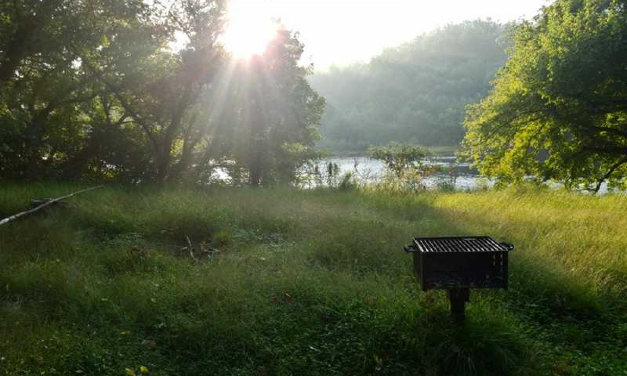
10. Toilets
Depending on your timing, you may not need much toilet paper. Every portable toilet we used had plenty of paper installed. Toilets are serviced every 7-10 days it seems. I strongly recommend hand sanitizer to prevent illness. Toilets are at each camp site, picnic area, most boat ramps, ferrys, etc. Picnic areas and pay campsites usually had permanent “outhouses” with septic systems. No running water at any stop with the exception of Great Falls (14) which has a full bathroom facility, and Swain’s Lock (16.5) which has a water pipe and a drinking fountain. There may be others, but these were all we saw.
11. Personal hygiene
There are no showers, unless you count hotels in the towns. “Fresh Bath” wipes help, but they leak and are heavy. Make sure you keep them in heavy duty ziplock bags to keep the juice out of your pack. A 4oz Nalgene Camp Suds bottle is useful for you and your clothes. If you can swing it and the weather is reasonable, I strongly recommend a dip in the river. (Not near rapids, dams, etc. of course.) You might have to wade through 3 feet deep of dead plant matter at the edge of the river, but once you get out to the regular river bed, a bath is easy and refreshing.
We met a couple with a solar shower. That may work for you, but keep in mind that privacy is rare on the C&O.
12. Bugs
Ticks are a serious problem in this region. Lyme disease is very common. You will be constantly brushing against tall grass, bushes, and basically communing with the bug world. I recommend treating your clothes and fabric equipment with Permethrin and keeping a good amount of DEET spray on hand for exposed skin. It will keep the mosquitos away and kill ticks on contact.
13. Electronic Devices
Charging cell phones is challenging on the C&O. Most of the trail is shady, and there are no outlets. The best solution I found is Lithium AA batteries with a Verbatim AA Power Pack that has USB out. It can do almost 2 full iPhone charges on 4 lightweight (but expensive) batteries. I had a Solarmonkey Adventurer, and this worked well also, except when we had a couple of rainy days in a row. I had to be stingy with my phone use (GPS, WordPress posts, etc.) so the solar panel could keep up. The last night I had to use the lithiums.
There is a big dead spot around Green Ridge State Forest. About 2 days of nothing for both AT&T and Sprint. (We had no Verizon). The rest of the trip had fair signal, improving greatly at and South of Harper’s Ferry.
Thanks for your help. I am planning on doing this hike in Mid-May. Great Falls to Cumberland on foot. Any advice?
Good luck! I hope you enjoy it. I’m actually thinking about doing it again this year. Is there anything in particular that you want to know? I wonder why you are starting at Great Falls instead of at mile zero? It’s just an extra half day. Then you could say you did the entire trail! 🙂
Good advice. The problem I face is that I only have the last two weeks in March to hike. I want to do a thru, but what are my water options at that point?
I’m planning on thru-hiking the whole thing in May/June. If anyone wants to join I’d like the company!
What are the rules for hikers?
We went on a hike today, Saturday of the memorial day weekend. Many bikers were on the path as well and some stayed on the right side but many didn’t, failed to yield right of way to hikers and NONE used horns bells etc. though some called out when approaching us from the rear.
I stayed on the left side of the path but my companion disagreed about which side we should stay on.
There were many bikers and we had a dog walking too, so I kept him on heal because of some of the bikers’ disregard of us.
Thank you for any answers, Elizabeth
Hey thanks for the info! I’m planning to solo hike the trail from Cumberland to DC in Sept this year. How many days total did you spend on the trail?
I am thinking of of taking my three boys on their first backpacking trip – ages 9, 7 & 7. Thought we would start in Cumberland and end in Hancock and average 10 – 12 miles a day. Do you think that is reasonable for kids that age? Any other thoughts or advice?
As someone who has family in Cumberland/Frostburg, you may want to consider doing the opposite direction. There’s a reason they say Cumberland is in the “mountains” of Maryland.
It looks like a wide, well maintained trail, does it start in a city? Or do you feel like you are in the wilderness when you do it?
Thanks for the guide! I thru-hiked the C&O last September and found your guide useful for prep, and I was especially grateful for it as it seemed to be the only one I could find online for hiking (as opposed to biking). To help remedy that scarcity, I wrote my own guide here (if you’re interested): http://www.riordanfrost.com/travel/hiking-the-co-canal-towpath-advice.
Hi Ed, it’s been 9 years since I did my last thru hike on the C&O(2008). Since 1994, I have thru hiked it 8 times. The last time I was on the trail was 2014, when I hiked from Cumberland to Harper’s Ferry, the head south on the Appalachian Trail.
I miss the C&O, and I am contemplating doing it again this year, probably starting in April. I spent a lot of time on the C&O, when I lived in Cumberland, and that’s where you could always find me. I usually went and did overnight camping on weekends, anywhere from Evitts Creek Campsite, to the PawPaw Tunnel.
One thing I do need to change as far as hiking, is finding shoes that last longer, and easy on the feet. With all the gravel, it ate the bottom of my shoes up, so it caused blistering on the bottom of my feet quite often.
I am looking forward to returning to Cumberland to do this again.
P.S. I earned this name of mine on the C&O. When I was hiking, I kept catching up with this other hiker, who was always in his tent sleeping. When I would wake up in the mornings, he would be gone. The last time I saw him was at Jordan Junction campsite, when he left me a note that read,
“You always sneak into camp when I am asleep. You have always been very quiet when pitching your tent, and any other thing you may be doing. So from this day forward, I shall call you WhisperingWind. See you at the next campsite!”
Sadly, I twisted my ankle the next day, and had to make my exit. So I was never able to catch him again…
Thank you. I am taking two grandsons (14 and 12) in April. We will watch the weather and then take appropriate clothing. Your recommendation not to take boots was helpful.
Thanks for this helpful advice. I am slowly easing myself into the idea of C&O Canal trekking. “Hikengripen” made me laugh out loud – thanks !
Thinking of doing the C&O next year. Looking for company ….planning on 8-10 miles a day and using B&Bs. In my 70s hence the lower mileage.
Hello. Next June we are hiking the Hancock to Harpers ferry leg of the trail. We will have at least 11 people going including 4 children ranging in age from 11 to 14. We are keeping the mileage down for the kids and to give us plenty of exploring time.. what do you think would be an average speed? I’ve already worked out our sites and how many miles per day but unsure how long say 8.5 miles will take. I have hiked the entire towpath several times as a kid but we did more miles so it was much longer. I do remember pulling 20 some miles into Antietam creek campsite . Thanks
I hope you have a great time! Both times we did the entire trail we kept the pace at exactly 20 minute miles, or 3 miles per hour. I actually set a timer for 20 minutes at every mile marker just for fun to see if we could hit the next marker right as the alarm went off. I’d guess with a group like that, 2 miles per hour is probably a better average target while walking. I think you might walk faster than that, but I’m guessing the large group size will mean lots of pauses. That would be a bit less than 5 hours of actual hiking per day leaving plenty of time for breaks and detours.
Best of luck!
How many days of food did you carry at most? Also, how did you store it at night? I’m worried about critters getting into my grub. Thanks for this guide. I plan on hiking the C&O and the GAP late summer/early fall.